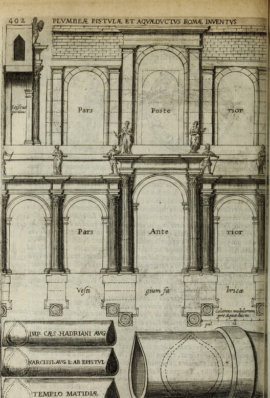
When the Ostrogoths laid siege to Rome in 537 AD, their very first military manoeuvre was to sever the city’s aqueducts. Eleven gravity-fed channels had long supplied the imperial capital with up to a million cubic meters of water per day—a volume more than sufficient to sustain a population exceeding one million, fill its sprawling public baths, and scour its subterranean sewers. Deprived of this life-sustaining infrastructure, Rome was instantly reduced to a vulnerable, fortified enclosure huddled around a contaminated river. The ancient siege demonstrated a foundational truth that has echoed through the centuries: water is fundamentally essential to a city’s existence.
Unlike land, which can be securely fenced off, or oil, which can be stored in tanks and barrels, water is an elusive resource that no single entity can fully own, yet everyone utterly depends upon. It flows restlessly through subterranean aquifers, crosses complex national borders, and carves paths down river valleys. The ancient Romans were acutely cognizant of this dynamic. Because the aqueducts constituted vital public infrastructure, the water spilling into public fountains was freely accessible to all citizens. Sextus Julius Frontinus, the administrator who oversaw Rome’s vast water system in the first century AD, meticulously documented every allocation, every illicit connection, and every abuse of the system with the precision of a civil servant who understood that water management was, at its core, a civic act. Architecture, in this sense, has always held the dual capacity to transform water into a common good or, conversely, to restrict it as a private privilege.
Upstream and downstream are positions within a watershed that dictate, with the ruthless precision of topography, precisely who must absorb the ecological and social consequences of political decisions. Architecture has always known how to harness gravity, mastering the physics of flow and pressure. What the discipline has been considerably slower to acknowledge is that gravity is inherently political.
The Dam
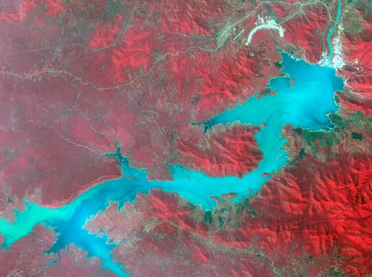
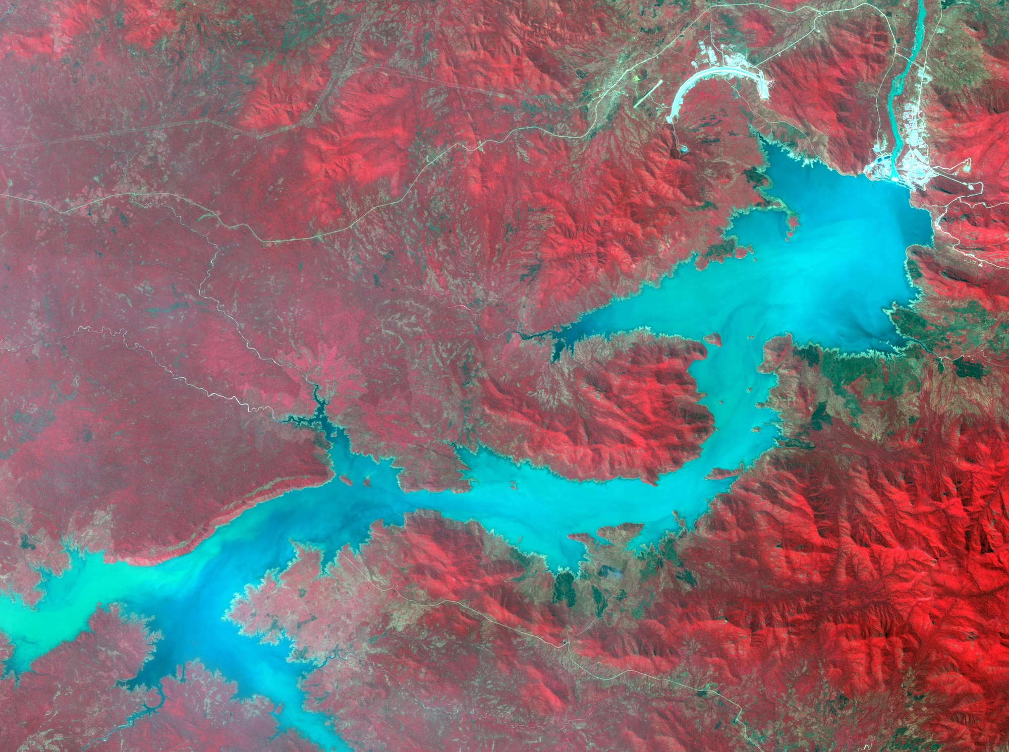
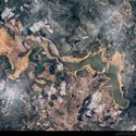
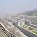
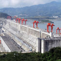
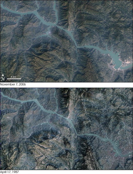
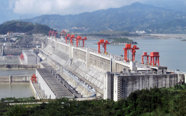
In 1997, Jiang Zemin, the fourth paramount leader of China, presided over a historic ceremony marking the diversion of the Yangtze River. Jiang famously declared that "man must conquer nature," a motto that came to define the ideological ambitions of the massive project. The primary wall of the Three Gorges Dam was completed in 2006, stretching 2.3 kilometers long and rising approximately 181 meters high. As the colossal reservoir filled over the course of several years, reaching its final operating height in 2010, it submerged 13 major cities, 140 towns, and 1,350 villages, alongside more than 1,300 known archaeological sites of immense historical value.
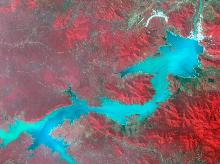
The Three Gorges Dam stands as the largest hydroelectric project ever constructed, as well as the largest forced resettlement initiative in human history. While the dam generates clean electricity that powers a significant portion of China’s bustling eastern seaboard, this monumental achievement came at a staggering human cost. More than 1.3 million people were displaced from their homes along the reservoir’s expanding edge. These included farming communities in Chongqing and Hubei whose fertile lands vanished beneath the murky waters, whose replacement plots on the steep, unstable hillsides above the waterline proved far too eroded to cultivate, and whose promised government compensation was frequently absorbed by administrative friction. While the project successfully protected approximately 15 million people downstream from catastrophic seasonal flooding, it displaced over a million citizens upstream.
This reveals the true architectural nature of the dam: not merely the engineering feat of its concrete face or the visual spectacle of its roaring spillways, but the territorial logic it enforces. Every hydrological impoundment generates a distinct geography of beneficiaries alongside a parallel geography of renunciation. A dam does not distribute its profound consequences according to human need or moral merit; rather, it distributes them according to position in the physical landscape—which is to say, according to pre-existing power structures. Architecture is far from being a neutral aesthetic vessel; it operates as an apparatus that organizes, sorts, and hierarchizes human bodies in space, and the massive dam is among the most explicit manifestations of that hierarchy.
The history of modern architecture is replete with admiration for large-scale hydraulic infrastructure, celebrating the precision of its engineering, the sheer scale of its ambition, and the imposing image of human civilization subduing natural systems. Yet, what is consistently omitted from these heroic narratives is the other side of the reservoir: the disappearing towns, the lost arable land, and the displaced communities. Architecture, much like any other professional discipline, produces its objects through the specific questions it chooses to ask. When architects and engineers ask how a dam stands, how its spillways perform, or how its immense mass meets the natural landscape, they are simultaneously choosing not to ask what the landscape was before, and whose ancestral land it truly was. Hydrology possesses sophisticated models for tracking sediment displacement; ecology maintains frameworks for measuring habitat loss; displacement studies utilize rigorous methodologies for tracking resettled populations. Architecture, however, which claims the organization of space as its core competence, has largely known what it erases without yet learning how to work meaningfully with what remains.
A similar narrative unfolded with the Aswan High Dam, completed in Egypt in 1970, which displaced an estimated 100,000 Nubians from their ancestral territory along the banks of the Nile. This displacement was described by scholars as epistemic, effectively erasing an indigenous culture that had already survived a previous displacement caused by the construction of the Aswan Low Dam by British colonialists in 1902. While the dam served as Egypt’s ultimate symbol of postcolonial modernity and rapid industrialization, the Nubians who sacrificed their ancestral villages to the reservoir bore the heavy cost of someone else’s national progress.
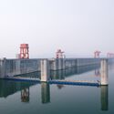
The Grand Ethiopian Renaissance Dam (GERD) on the Blue Nile reopens this complex history from the opposite perspective. When Ethiopia initiated construction on the massive project in 2011, it shattered a rigid water allocation framework that had persisted since the colonial era. A 1929 treaty, later renegotiated in 1959, had guaranteed Egypt an annual supply of 55.5 billion cubic meters of Nile water while granting Cairo effective veto power over any upstream infrastructure development. That foundational treaty was signed without Ethiopia’s participation and allocated the entirety of a major international river between Egypt and Sudan. Yet, the river’s largest tributary—the Blue Nile, which contributes roughly 85 percent of the Nile’s total flow—originates directly in the Ethiopian highlands. Despite supplying the vast majority of the water, Ethiopia was legally entitled to use less than one percent of it. The colonial framework had successfully built a legal structure that controlled the river’s benefits as surely as any physical concrete impoundment.
The GERD, now the largest dam in Africa, represents Ethiopia’s firm assertion that this unequal arrangement was nothing more than an obsolete colonial artifact. Conversely, Egypt maintains that the dam constitutes an existential threat to its national water security, noting that 98 percent of its renewable water resources originate from the Nile. Without a guaranteed minimum annual flow, the nation’s vital agricultural sector and electricity generation systems face imminent collapse. These represent two irreconcilable claims over the exact same river, both grounded in genuine national necessity. Unlike the communities displaced by the Three Gorges, who were at least nominal subjects of the state that relocated them, Egypt possesses no direct legal mechanism to compel a sovereign upstream neighbor.
Day Zero
In January 2018, the municipal government of Cape Town announced an alarming reality: the city was rapidly approaching a threshold where local dam levels would fall below 13.5 percent of total capacity. At that critical juncture, the municipality would be forced to shut off the municipal taps to the vast majority of the city’s 3.7 million residents. The widely publicized "Day Zero" announcement quickly captured international headlines, serving as stark evidence of a terrifying new kind of urban catastrophe—a major modern city teetering on the verge of running completely out of water. Fortunately, by July of that year, robust winter rains pushed local dam levels back above 50 percent, and the immediate crisis was officially declared over.
Across many urban centers throughout the Global South, water infrastructure was originally designed for populations that were significantly smaller, less dense, and distributed according to strict colonial planning logics. These systems were engineered to reserve formal utility services for privileged neighborhoods while systematically withholding them from others. As these cities experienced massive informal growth, they absorbed millions of new residents into settlements that proliferated along the urban periphery. Existing municipal infrastructure failed to expand to accommodate this new demographic reality, leaving these areas devoid of adequate water pressure, metered connections, and the vital redundancy that ensures a resilient system. By 2018, the informal settlements of Khayelitsha and Mitchell’s Plain were forced to rely on communal standpipes delivering less than 25 liters of water per person per day—ironically mirroring the severe emergency rationing proposed for the formal city under the Day Zero plan.
During the apartheid era, water and sanitation services in South Africa were sharply divided across 25 separate municipalities, each exclusively serving a racially designated population. Townships received only what remained after white residential areas had been fully supplied, and the subterranean pipes reaching those marginalized areas were frequently neglected by design. When apartheid officially ended in 1994, this deeply unequal physical infrastructure did not simply vanish. By 2018, formal households still consumed 66 percent of Cape Town’s total water supply, while informal settlements—home to 14 percent of the city’s households—consumed a mere 4 percent. Consequently, the harsh water restrictions introduced during the drought fell equally upon a household consuming 300 liters a day and a household already surviving on 30.
Anthropologist Nikhil Anand, who studied Mumbai’s intricate water infrastructure, characterized this urban condition as "hydraulic citizenship"—referring to the capacity of residents to be officially recognized by municipal agencies through legitimate, connected water systems. Those who remain unconnected are not merely underserved; within the administrative logic of the local government, they are treated as not yet fully urban. Geographer Erik Swyngedouw, whose research spans Guayaquil and other cities across the Global South, argues that water does not flow merely according to basic human need, but rather through deeply entrenched networks of power, technology, and meaning, effectively turning scarcity into a socially produced condition. In Guayaquil, where 600,000 people lacked reliable access to potable water despite the city sitting atop abundant natural resources, impoverished neighborhoods were forced to rely on private tanker trucks that charged exorbitant prices, consuming a disproportionate share of household income. The struggle for water in cities like Guayaquil and Cape Town is, as Swyngedouw asserts, fundamentally a struggle for the right to the city itself.
The Border
Political theorist Stuart Elden argues that contemporary geopolitical thought has long misconceptualized territory by viewing it primarily as a flat surface to be divided on a map rather than as a volumetric space extending vertically above and below the ground, deep into the sub-soil and marine environments. China is actively operationalizing this volumetric perspective in the South China Sea, where Beijing is not merely claiming a traditional line on a navigational chart, but is actively constructing a physical volume. By dredging vast amounts of material from the seabed, depositing it to raise reefs above the waterline, and subsequently asserting that the column of airspace above and the water surrounding the new landmass now fall under a different political jurisdiction, the state is redefining territoriality.
The United Nations Convention on the Law of the Sea (UNCLOS) was drafted for a traditional world of flat surfaces. In contrast, the artificial island operates entirely within depth. Modern territorial law, including the legal architecture governing international waters, was built on the assumption of surfaces—such as the drawn boundary line or the continental shelf. What remains conspicuously absent from these legal frameworks is depth, which would allow for simultaneous political control over what lies both above and below the water.
Between December 2013 and October 2015, China aggressively dredged sand and coral from the seabed of the Spratly Islands, depositing the material onto seven submerged reefs to create nearly 3,000 acres of entirely new landmass. What was constructed was not a surface claim, but a volume. By extracting material from the seabed, elevating it above the waterline, and asserting sovereignty over the surrounding water column and airspace, China manufactured physical ground to substantiate political claims from the sub-surface material of the sea itself. China’s Ministry of Foreign Affairs consistently defended the construction as necessary for optimizing maritime functions and improving living and working conditions in the area.
Under UNCLOS, artificial islands do not legally generate a territorial sea of their own. A landmark 2016 arbitral tribunal ruling, initiated by the Philippines, decisively concluded that China’s expansive nine-dash line maritime claim had no legal basis under international law, and that China had directly violated the sovereign rights of the Philippines. Yet, the geopolitical pattern remains remarkably consistent: build the infrastructure first, dispute the legality later, and rely heavily on the reality that no international enforcement mechanism exists that is capable of physically removing what has already been constructed.
Across every case examined, water has been actively directed, contained, rationed, and physically manufactured into territory through the intervention of infrastructure. The resulting architecture is irreversible in a way that legal arguments rarely are—and that, ultimately, is the central point.